План за интегрирано развитие на община Гулянци
All projects

Integrated Development Plan · Gulyantsi Municipality · 2020

Integrated Development Plan of Gulyantsi Municipality

43.6409, 24.6944

01 / Summary

Participation as a subcontractor in the development of the Integrated Development Plan of Gulyantsi Municipality for the 2021–2027 period, through the development of graphic materials and thematic diagrams that spatially present the main analyses, characteristics and proposals set out in the plan.

Location
Gulyantsi Municipality, Pleven
Category
Integrated Development Plan
Period
2020
Role
Subcontractor
Status
Completed
02

What was done

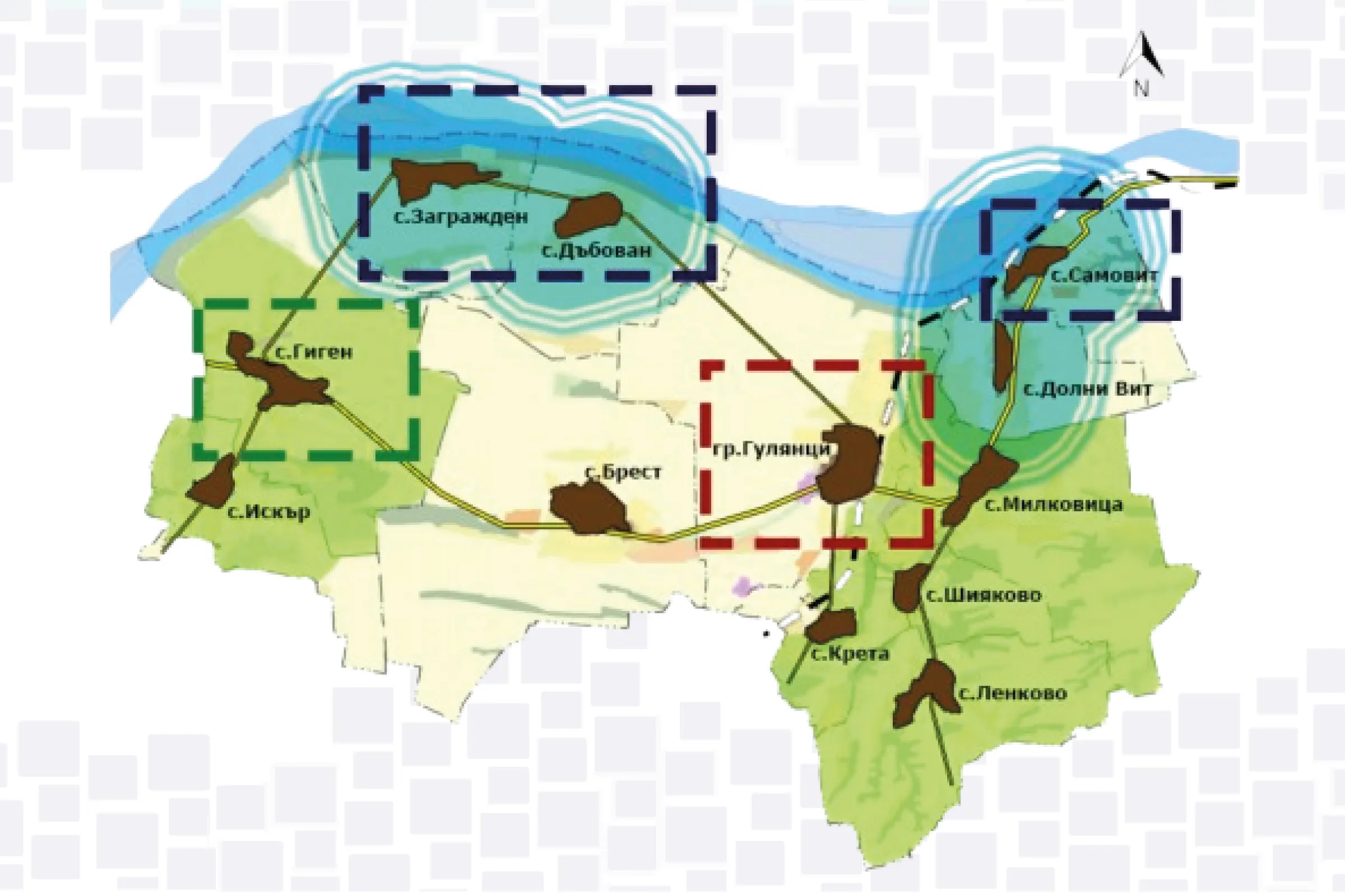
Participation in the development of the graphic and illustrative materials for the Integrated Development Plan of Gulyantsi Municipality for the 2021–2027 period. Thematic diagrams were developed presenting the spatial structure, the main characteristics of the territory, the priority impact zones, and the municipality's development potential. A Geographic Information System (GIS) was used in preparing the diagrams for data processing, analysis and spatial visualisation.

03

Scope

As part of the work on the Integrated Development Plan, numerous diagrams and graphic materials were developed presenting various aspects of the territorial development of Gulyantsi Municipality. As an example of the materials developed, one diagram presents the three main priority impact zones — the "Municipal Centre Zone", the "Ulpia Escus Zone" and the "Danube Riverside Zone". It shows the main road links, the railway line, the Danube River, the recreation and tourism zones, as well as the territories related to environmental protection and risk prevention. For each of the priority zones, the corresponding priorities and impact directions are presented.

04

Result

The diagrams developed provide a clear and legible spatial presentation of the information included in the Integrated Development Plan and support an understanding of the municipality's territorial characteristics, interrelations and development potential. The graphic presentation of the priority zones, infrastructure, natural and tourism resources, and territories with specific regimes facilitates the visual perception of the plan's main directions and proposals.