Общ устройствен план на община Рудозем
All projects

General Spatial Development Plan · Rudozem Municipality · 2020

General Spatial Development Plan of Rudozem Municipality

41.4892, 24.8454

01 / Summary

Development of the General Spatial Development Plan of Rudozem Municipality as joint work within the "DZZD PALE" consortium. The plan creates a planning and spatial foundation for the long-term development of the municipality's territory, defines the main development directions and planning structure, and provides a framework for the subsequent planning and management of the territory.

Location
Rudozem Municipality, Smolyan
Category
General Spatial Development Plan
Period
2020
Role
PALE DZZD
Status
Completed
02

What was done

Participation in the entire process of developing the General Spatial Development Plan of Rudozem Municipality through joint work within the "DZZD PALE" consortium. The work included research and analysis of the territory, assessment of the existing condition and development potential, spatial and land-use planning, development of the planning proposals, and preparation of the necessary graphic and text materials.

03

Scope

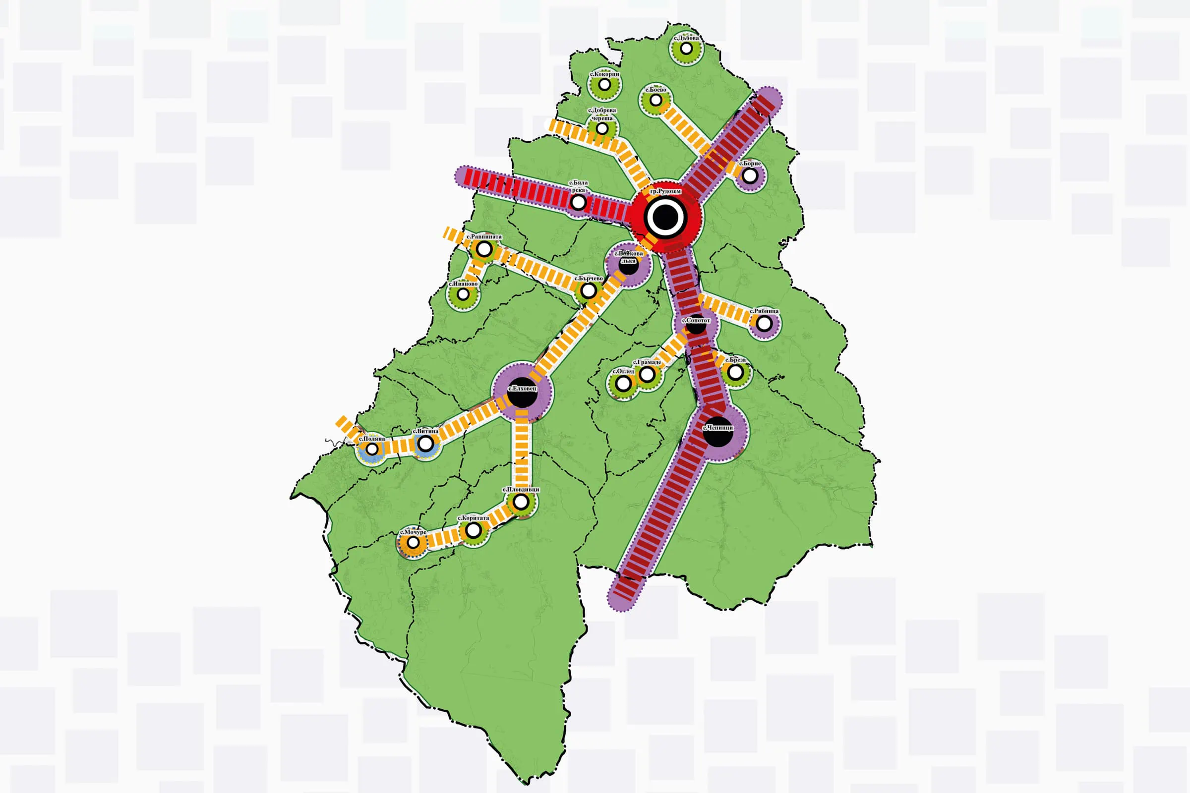
The work covers the territory of Rudozem Municipality and includes a comprehensive study of the natural, demographic, socio-economic, infrastructural and spatial characteristics of the territory. The development included analysis of the existing planning structure, settlements, transport and technical infrastructure, natural resources, and development constraints. A spatial assessment of the territory's potential and problems was carried out, and planning proposals related to the future development and functional structuring of the municipality were developed. During the work, the necessary graphic materials and diagrams were prepared, presenting the spatial characteristics and planning proposals.

04

Result

An up-to-date spatial and planning foundation was created for the balanced and sustainable development of Rudozem Municipality. The General Spatial Development Plan assists the municipality in managing and developing the territory, determining the appropriate designation and layout of the various zones, and guiding future investment development. The plan creates the necessary foundation for subsequent detailed planning, while also supporting the combination of tourism, infrastructure and economic development with the protection and sustainable use of natural resources and cultural heritage.